Latest Photos

Head Marala - Sialkot Daokhan Forest Rest House, Leepa Valley, Azad Jammu & Kashmir, Pakistan Pine tree. Kalar Kahar lake Culture Of Pakistan ! PAF Museum, Karachi Ratti Gali Lake, Neelum Valley, AJK, Pakistan Ratti Gali Lake, Neelum Valley, AJK, Pakistan Birds of Sindh. Bulbul & more PAF Museum Karachi Head Marala - Sialkot
Search this blog..

Top Stories of the week

ERROR - UNABLE TO LOAD CONTROL : /controls/linkexchange/plug_linkexchange.ascx limit=9;The file '/controls/linkexchange/plug_linkexchange.ascx' does not exist.

Gilgit-Baltistan

Posted in : Gilgit-Baltistan, Gilgit

(added few years ago!)

Gilgit is the capital city of Gilgit-Baltistan, Pakistan. Its ancient name was Sargin, later to be known as Gilit, and it is still called Gilit or Sargin-Gilit by local people. In the Burushaski language, it is named Geelt and in Wakhi and Khowar it is called Gilt. Ghallata is considered its name in ancient Sanskrit literature. Gilgit City is one of the two major hubs in Gilgit Baltistan for mountaineering expeditions to the Karakoram and other the peaks in the Himalayas, the other hub being Skardu.

Gilgit was an important city on the Silk Road, along which Buddhism was spread from South Asia to the rest of Asia.

The Dards and Chinas appear in many of the old Pauranic lists of peoples who lived in the region, with the former also mentioned in Ptolemy's accounts of the region. Two famous travellers, Faxian and Xuanzang, traversed Gilgit according to their accounts.
 
Gilgit city is one of the two major hubs for all mountaineering expeditions in Gilgit-Baltistan. Almost all tourists headed for treks in Karakoram or Himalaya Ranges arrive at Gilgit first. Many tourists choose to travel to Gilgit by air, since the road travel between Islamabad and Gilgit, by the Karakoram Highway, takes nearly 14–24 hours, whereas the air travel takes a mere 45–50 minutes.
 
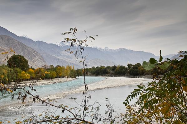
There are several tourist attractions relatively close to Gilgit: Naltar Valley with Naltar Peak, Hunza Valley, Nagar Valley, Ferry Meadows in Raikot, Shigar town, Skardu city, Haramosh Peak in Karakoram Range, Bagrot-Haramosh Valley, Deosai National Park, Astore Valley, Rama Lake, Juglot town, Phunder village, Yasin Valley and Kargah Valley.
 
Location:
View Larger Map 


Read the rest of this entry »

(added few years ago!) / 10202 views

Babusar Pass or Babusar Top

Posted in : KPK, Kaghan Valley, Mountains / Peaks / Passes

(added few years ago!)

Babusar Pass or Babusar Top (el. 4173 m./13,691 ft.) is a mountain pass at the north of the 150 km. (93 miles) long Kaghan Valley connecting it via the Thak Nala with Chilas on the Karakoram Highway (KKH). It is the highest point in the Kaghan Valley.

The Kaghan Valley is at its best during summer (months ranging from May to September). In May the maximum temperature is 11 C (52 F) and the minimum temperature is 3 C (37 F). From the middle of July up to the end of September the road beyond Naran is open right up to Babusar Pass. However, movement is restricted during the monsoon and winter seasons. The Kaghan area can be reached by road via the towns of Balakot, Abbottabad and Mansehra.

Location :
View Larger Map 


Read the rest of this entry »

(added few years ago!) / 5667 views

Lulusar Lake

Posted in : KPK, Kaghan Valley, Lakes

(added few years ago!)

Lulusar Lake, at 3,410 m (11,190 ft), is the primary headwaters of the Kunhar River.It flows southwest through the entire length of Kaghan Valley and the Naran Valley, passing Jalkhand, Kaghan, Jared, Paras and Balakot until its confluence with the Jhelum River. Lulusar Lake marks the historic place where fifty-five participants of the 1857 Indian war of independence were arrested.


Lulusir Lake, and a neighboring small lake 'hidden' behind the curving ridge.
 
The lake is much larger than other lakes in the Kaghan Valley, and has mirror-like water reflecting the surrounding snowcapped Lulusar mountains, creating a natural tourist attraction. In the summer many domestic and international visitors make the lake and Lulusar-Dudipatsar National Park a destination. From Gittidas east of the lake the Naran-Babusar road goes through the Babusar Pass, which is the highest point in the Kaghan Valley (el.4,173 metres (13,691 ft)), to the Karakoram Highway and mountaineering hub of Gilgit.
 
From Naran Village the Naran-Babusar road ascends 48 kilometres (30 mi) northeast up Kaghan Valley to Basel, from where one reaches Lulusar Lake. Jeeps can be hired in Naran for visiting the lake. A road is being built southeast around the lake which will link Naran and Basel to Chilas and the Karakoram Highway south of Gilgit.
 
Location :
View Larger Map 


Read the rest of this entry »

(added few years ago!) / 3809 views

Lake Saiful Muluk - Naran

Posted in : KPK, Kaghan Valley, Hill Stations, Lakes

(added few years ago!)

Lake Saiful Muluk is located at the northern end of the Kaghan Valley near Naran. It is in the north east of Mansehra District in the Khyber-Pakhtunkhwa province, Pakistan. At an altitude of 3,224 m (10,578 feet) above sea level it is amongst one of the highest lakes in Pakistan.

The weather here is moderate during day time while the temperature drops to minus degrees at night.


A fairy tale called Saiful Muluk, written by the famous sufi poet Mian Muhammad Bakhsh, is associated with the lake. It is the story of the prince of Persia who fell in love with a fairy princess at the lake. The impact of the lake beauty is of such extent that people believe that fairies come down to lake in full moon. A poet and writer from Balakot Dr Mujahid hussain wrote the story of Saiful Muluk in prose depicting the local version.
 
The Guardian ranked Lake Saiful Muluk as the 5th Best Tourist Destination in Pakistan. Mansehra District has had a flourishing tourism industry in the past due to its many mountain ranges and the Saiful Muluk Lake. However, since the 2005 earthquake the region has seen a decrease in tourists. This lake is about three thousand feet above the ground level of Naran, this beautiful lake reflects many colors in minutes.
 
Location :
View Larger Map


Read the rest of this entry »

(added few years ago!) / 4535 views

Naran - Kaghan Valley

Posted in : KPK, Kaghan Valley

(added few years ago!)

Naran

Naran is a village located in Kaghan Valley, Mansehra District of Khyber-Pakhtunkhwa province of Pakistan. 


The Kunhar River, swollen by glacier melt, passes through this village as it meanders its way through the valley. The village is major tourist spot. It has over 100 hotels of various types ranging from high-end luxury hotels to very low priced motels. Tent motels are also present which rent family size tents to tourists to stay in. Usually tourists stay at Naran to visit popular tourist spots nearby such as Lake Saif-ul-Malook and Lalazar which can only be accessed via 4x4 jeeps which can be hired for day exertions. PTDC also has a motel situated in the north of village which can accommodate people on different tariffs, from average rooms to costly huts besides the River Kunhar.
 
Location:
View Larger Map 


Read the rest of this entry »

(added few years ago!) / 6044 views

Balakot - Mansehra

Posted in : KPK, Mansehra

(added few years ago!)

Balakot is a town in Mansehra District in the Khyber-Pakhtunkhwa province of Pakistan. 

Balakot is located about thirty eight kilometers north east of the city of Mansehra, in Khyber-Pakhtunkhwa. It is a historical town, a famous tourist destination of the region and the gateway to Kaghan valley. The river Kunhar, originating from Lulusar lake, runs through the city and merges with Jhelum River just outside Muzaffarabad in Azad Kashmir.


Balakot is one of the main cities of Mansehra District. It serves as the chief city of Balakot Tehsil, which is the largest Tehsil of Mansehra District. It is also a Union Council and administers the many surrounding smaller towns and villages.
 
The town or village of Balakot is occupied mainly by members of the Swati , Awan, Gujar, Syed,Turk, Mughal and Hanki tribes. It is located on the banks of the River Kunhar before it enters the Kashmir Valley. The Sikhs tried to free Mansehra in the 1818 but were met with resistance from the occupying army. As the Mansehra region fell under Sikh control, it was annexed to Punjab. The movement placed Waziristan, the Mohmand country beyond Kunhar, Chitral and Yusufzai tribes within the control and responsibility of the Indian government. Syed Ahmad Shaheed and Shah Ismail Shaheed, with the help of the Mujahadeen, including the local tribes of tehsil Balakot from Kaghan to Garhi Habibullah led many revolts and attacks against the Sikhs. At last on 6 May 1831, during a fierce battle, Syed Ahmad Shaheed and Shah Ismail Shaheed along with hundreds of their followers were killed. The central mosque of Balakot is named after Syed Ahmed Shaheed. The areas includes diverse groups, the spoken languages are Hindko and Gojri.
 
Location :  
View Larger Map 


Read the rest of this entry »

(added few years ago!) / 5847 views

Hotel Broadview & Camping Site, Fairy Meadows

Posted in : Gilgit-Baltistan, Hotels, Gilgit-Baltistan, Hill Stations

(added few years ago!)

The NANGA PARBAT BROAD VIEW Hotel & Camping Site located at a distance of five minutes hike from main village and other tourist resorts overlooks the five adjacent peaks of Nanga Parbat locally called Raikot Peak, Chongra Peak, Ganalo Peak & Susrobush Peak.It also presents an enchanting view of Raikot Glacier.

Accommodation

Log cabins with or without attached baths & camping arena is available having the enchanting view of Nanga Parbat. Tourists can pitch their own tents or, they can hire tents from staff. Dining area & kitchen are located adjacent to camping site. Toilets & baths can be reached very comfortably from cabins & tents. The whole area is demarcated with a controlled access and the tourists are free to enjoy the privacy within the vicinity.
 
Hikes & Treks
The famous day hike from Broad View Hotel is for Beyal Camp & the base camp of Nanga Parbat. Friendly and experienced mountain guides, who are familiar with the terrain, accompany the visitors. Staff at Broad View Hotel is experienced and help trekkers in planning their routes. Camping equipment & food can also be arranged for these treks.
 
Food
Fresh Pakistani and European meals are available in comfortable Dining Hall.
Local food can also be prepared upon request.
 
Contact
For Reservation and more Information
hotel.broadview@gmail.com
 
Fazal Ur Rehman
P.O Gonar Farm District Diamir Tehsil Chilas Northern Areas, Pakistan
Phone:
+ 92 (0) 322-2226323
+ 92 (0) 312-9852840
+ 92 (0) 312-9705843
 
Location:
 

Read the rest of this entry »

(added few years ago!) / 4266 views

Rawal Lake - Islamabad

Posted in : Punjab, Islamabad, Lakes

(added few years ago!)

Rawal Lake in Pakistan is an artificial reservoir that provides the water needs for the cities of Rawalpindi and Islamabad. Korang River along with some other small streams coming from Margalla Hills have been set to form this artificial lake which covers an area of 8.8 km². Korang River is the outlet stream of Rawal Dam. Rawal Lake is located within an isolated section of the Margalla Hills National Park.

The area around the lake has been planted with flowering trees and laid out with gardens, picnic spots, and secluded paths. The terraced garden and the lake are used for picnics, fishing and boating. The highest point in the garden offers a panoramic view of the lake, Margalla and Murree hills, Rawalpindi and Islamabad.

Boating, sailing, water skating and diving facilities are organized by private clubs.
To the west of the lake is the Islamabad Club, which offers different sporting facilities.
 
The reservoir is of considerable importance for wintering waterfowl, especially Anas platyrhynchos.
Resident mammals include the common fox, Pangolin, Porcupine, Jungle cat, Jackal, Wild boar and yellow-throated marten.
Reptiles include indian cobra and Russell's viper.
It is a good place for birds watching, as the majority of Birds of Islamabad are found here.
 
Location:
 

Read the rest of this entry »

(added few years ago!) / 2894 views

Lake Manchar

Posted in : Sindh, Dadu, Lakes

(added few years ago!)

Lake Manchar is the largest freshwater lake in Pakistan and one of Asia's largest. It is located west of the Indus River, in Dadu District, Sindh. The area of the lake fluctuates with the seasons from as little as 350 km² to as much as 520 km². The lake collects water from numerous small streams in the Kirthar Mountains and empties into the Indus River.

The lake was created in the 1930s when the Sukkur Barrage was constructed on the river Indus. The lake is fed by two canals, the Aral and the Danister from the river Indus. Until recently the lake supported thousands of fisherfolk, near village Kot Lashari Bobak railway station,who depended on the freshwater fish they caught in the lake. However, the lake is now undergoing environmental degradation resulting in the water becoming saline and killing off the fish and forcing the fisherfolk to look elsewhere for employment.

The degradation has been occurring for a long time but only recently have the effects been felt. The diversion of water from the Indus and a diminished storm runoff from the Kirthar mountains have contributed to the reduction in fresh water supplies. At the same time, saline drainage water from agricultural fields in surrounding areas has started to flow into Lake Manchar.
 
The lake was a stop-off on the Indus flyway for Siberian migratory birds, but recently the numbers have fallen from 25,000 birds counted in 1988 to just 2,800 bird counted in 2002, because the lake no longer provides the birds' main food, the lake fish. In the place of the birds, the lake now hosts a saline water reed.
The lake also provided large volumes of water for irrigation but this has also been reduced and has resulted in a great reduction in the area irrigated by the lake.
 
Location :


Read the rest of this entry »

(added few years ago!) / 2924 views

Kalri Lake or Keenjhar Lake

Posted in : Sindh, Thatta, Lakes

(added few years ago!)


At a distance of 120 km from Karachi while travelling towards hyderabad on National Highway is Keenjhar Lake famous as Kalri Lake.
 
It is situated in Thatta District, Sindh, Pakistan and is 18 km away from Thatta town.


Kalri Lake is the largest freshwater lake of Pakistan. It is the main source of drinking water for Karachi. The lake draws bulk of water from River Indus 
 
through a canal KB Feeder which originates from Kotri Barrage.
 
The lake has been declared a ramsar site and a wildlife sanctuary. It is home to winter migratory birds like Ducks, Geese, Flamingos, Cormorants, Shorebirds, Herons, Egrets, Ibises, Terns, Coots and Gulls.
Kalri lake is also a popular tourist resot for pepole of Karachi, Hyderabad and Thatta. 
 
Famous Sindhi folklore of Sindhi legend Noori Jam Tamachi also took place around the lake.
In the middle of the lake there is a shrine marking the Noori's grave. It is a famous spot and can be seen from the shore. 
Hundreds of devotees visit the shrine to offer fateha.
 
Location :
 

Read the rest of this entry »

(added few years ago!) / 5006 views